Hiking Hurricane Mountain

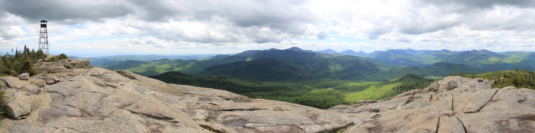
A Year Round Adventure – Hurricane has a wonderful open summit with incredible views from the 3694′ elevation. Three trails lead to the summit, with the trailhead on Route 9N being the most popular option.
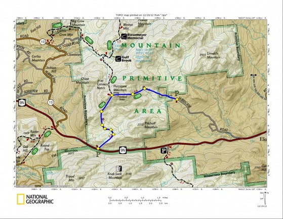
The Trails
South. This trail climbs steeply at first from Route 9N, then levels out, crosses a series of bridges across beaver swamps, and then resumes a gradual climb with switchbacks to a rock ledge overlook at 2.8 miles. The North trail joins just before reaching the final rocky summit, at 3.4 miles. Elevation gain is 2,000 feet.
Total hike is 6.8 miles round trip and is considered a moderate climb for the regular hiker.
North. This trail starts at Crow Clearing, off O’Toole Road, Keene and rises 1,600 feet over 3 miles. The first mile is virtually flat, and passes close to the recently rebuilt Gulf Brook lean-to.
East. This was the trail used by fire tower observers, from 1919 to 1979, and it passes the site of the old cabin used by observers and their families during the work season. It begins at the end of Hurricane Road, west of Elizabethtown, and climbs 1,700 feet over 2.7 miles. Much of the first mile is very flat, so the final section is quite steep.
Map
Directions